Description
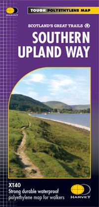
The Southern Upland Way is Britain’s first official coast to coast long distance walking route and is one of Scotland’s Great Trails. It is 340km (212 miles) in length, from Portpatrick on the south west coast of Scotland to Cockburnspath on the eastern seabord. It offers superb and varied walking country, taking you through an enormous variety of scenery.
Tough, light, durable and 100% waterproof
Includes Rights of Way
Genuine original HARVEY mapping
Route clearly marked
Technical specification: Scale/Maßstab: 1:40.000 Ratio: 2.5cm = 1km Flat size/Maße ungefaltet: 1160 x 486mm Folded size/Maße gefaltet: 116 x 243mm Weight/Gewicht: 60gms Double sided/beidseitig bedruckt Format: strip map
| Gewicht: | 60 g |
|---|---|
| Verlag: | Harvey Map |
| Reihe: | Harvey Weitwanderkarten |
| Maßstab: | 1:40.000 |
| Medienart: | Karten |
| Sprache: | Englisch |
| EAN: | 9781851376025 |
| Höhe in mm offen: | 486 |
| Erscheinungsjahr: | 2018 |
| Kontinent: | Europa |
| Land: | Vereinigtes Königreich (Großbritannien) |
| Bundesland / Provinz: | Schottland |
| Region: | Southern Uplands |
| Orte / Berge / Seen: | Melrose, Cockburnspath |


Reviews
There are no reviews yet.